The path of the masi
Excerpt from www.castelloditoppo.com
"An itinerary for the knowledge of the rural village
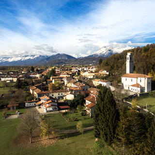
The path of the masi, which begins at Palazzo Toppo-Wasserman (see map), leads to the discovery of the original nuclei of the rural village of Toppo, which developed in a feudal county linked to the manor castle that dominated it from the slopes of Mount Ciaurlec.
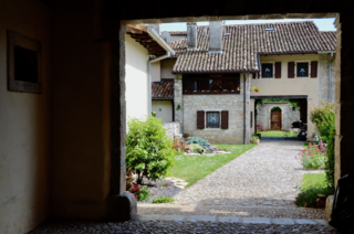
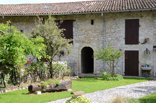
The medieval village, which was based on pre-existing Roman-era structures, appears composed of two distinct nuclei: Pino and Toppo, separated by the Gleria stream. In these hamlets, the settlement of the farming community was organized with the system of masi. The masi were a sort of small family-run farm consisting of a plot, with residential structures and gardens, and plots of arable land, usually very fragmented and scattered nearby. It was also a basic unit for determining census and taxes. In Toppo, the village organization based on masi, typical of the medieval manorial system, appears well documented until the end of the 17th century. A situation that has left important traces in the urban planning and architecture of the current village, which arose from the continuous evolution of the ancient masi and the fragmentation of family groups.
Historical research and cartographic analysis have made it possible to identify and locate still a good part of the masi plots. Fundamental for identifying the site of the ancient agricultural settlements is the toponymic mapping of family surnames – dating back to the 15th-16th century and, especially, to the mid-1700s – which coincide with courtyards and buildings attested in documents and recognizable in the cadastral maps of the 19th century. Following the location of the various families within the settlement, it was discovered that some nuclei have occupied the same courtyards for many centuries and still reside there. In Toppo, the oldest attestations of the masi system date back to the medieval age. A document from 1431 contains a description of the assets belonging to the lords of Toppo since the beginning of the 13th century, among which 8 masi located in the nuclei of Pino (4) and Toppo (another 4) appear. Starting from the 16th century, the masi of the hamlets of Toppo and Pino appear, however, to be many more: at least 25. Since that period, the village at the foot of the feudal castle appears characterized by two distinct poles, separated by the Gleria stream, and identified with the masi of Toppo, towards the east (nos. 3, 4, 5, 7, 15-19, 22, 23 on the maps), and of Pino, more to the west (along the current via Verdi and via Castello; nos. 1, 2, 8, 10-13, 16, 21, 24 on the maps).
Il Borgo di Pino
The core of Pino, to the west of the rio Gleria, was located right at the foot of the Castle. Here, the Renaissance palace of the Conti Toppo Wassermann was also erected when the local lords decided to abandon the ancient manor. This village appeared to revolve around the road leading to the castle and was characterized by the presence of a square and a large pool or pond. There was also a road junction (the beorchia) which must have been a significant place in the settlement as it is mentioned several times as a topographical indication. Right near the junction, two of the oldest farmhouses are located, and the noble palace of the counts was later built.
Il Borgo di Toppo
The core of Toppo stretched further east along the current via Nazario Sauro and via della Fornace. The toponym Toppo, also used to identify the noble house that ruled the castle, was more fortunate and survived to our days. This is probably due to the presence in this core of the village church, dedicated to San Lorenzo martire.
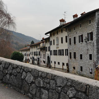
The church is noted as existing as early as 1220. In 1505, the establishment of the Parish was authorized, confirming its role as a point of attraction for settlement in the area over the centuries. Here, in fact, there is significant development of the system of farmsteads and the settlement even after the medieval period. The dates engraved on the keystones of the gates testify to this continuous growth. In the Napoleonic and Austrian cadastre (early 19th century), it emerges that precisely along via Nazzaro Sauro and via della Fornace, the urban planning of the village became richer and more articulated.
In addition to the original plots of the farmsteads, still clearly readable but architecturally enhanced, the built-up areas are larger and the residential complexes are more cohesive. Undoubtedly, this appears to be the central core of the villa of Toppo, which thanks to its centuries-old evolution, is composed not only of plots of farmsteads but also of other houses and courtyards.
Some structures then show a certain architectural quality.
These are presumably buildings belonging to families of small independent owners, long settled near the oldest farmsteads, on land perhaps coinciding with the old bearzi (gardens). After the 1976 earthquake, reconstruction activity partially modified the urban layout, particularly along via Nazzaro Sauro. However, the features of the system of farmsteads that constituted the core of the original village can still be read.


